Free Shipping on orders over $500


Leica 746157 IR Remote Control for Leica Piper Pipe Lasers
Up to 500 feet (150 meters) line-of-sight Range
Cover large layout jobs with a Up to 500 feet (150 meters) line-of-sight working reach.
Authorized Leica Geosystems Dealer
Genuine, factory-fresh Leica Geosystems equipment with legitimate firmware and calibration documentation.
Same-Day Shipping
In-stock orders placed before 2 PM CT ship the same day.
Buy With Confidence
Compatibility and setup details on every product, plus our AI assistant for quick questions.
Authorized Dealer
Genuine equipment sourced straight from manufacturer partners.
Ships Same Day
Orders placed before 2 PM CT leave the dock today.
Genuine Gear
Factory-fresh, authentic units with legitimate firmware.
Best-Price Guarantee
Authorized-dealer pricing on every unit — request a quote anytime.
What's In The Box
Included Components
Everything that ships with the Leica 746157 IR Remote Control for Leica Piper Pipe Lasers — 1 item.
- Leica GS18 T GNSS Rover Receiver
Kit Builder
Not sure what goes with this accessory?
Answer a few job questions and our Kit Builder assembles the full setup — receiver, rod, tripod, and case matched to your workflow.
Quick Answer
What is the Leica Geosystems 746157?
The Leica 746157 IR Remote Control for Leica Piper Pipe Lasers is a Leica Geosystems professional jobsite instrument with Up to 500 feet (150 meters) line-of-sight control range. It's available from Express Tools as an authorized Leica Geosystems dealer with same-day shipping on in-stock orders.
What contractors use this accessories for
Confined-Space Survey Work
Surveyors working in alleyways, between buildings, and under dense tree canopy use the GS18 T's IMU tilt compensation to measure accurately without requiring rod plumbing checks or calibration delays. The instant tilt correction eliminates setup time and reduces re-measurement errors, allowing crews to move faster through tight job sites.
Trench and Utility Staking
Contractors staking utility lines, drainage, or underground infrastructure in confined trenches rely on the GS18 T's no-calibration IMU to deliver accurate shots even when rod angle cannot be perfectly vertical. This real-time tilt compensation speeds utility location and reduces costly measurement disputes.
Urban and Metro Area Positioning
Survey crews in cities with tall buildings and signal obstruction benefit from the GS18 T's six-constellation reception, which maintains robust RTK solutions where single-constellation receivers lose fix. Faster convergence and fewer re-initializations mean crews complete more shots per day in complex urban environments.
Remote and Forested Site Work
Projects in areas with partial canopy blockage and limited cellular infrastructure use the GS18 T's multi-constellation approach and flexible UHF/4G/Wi-Fi connectivity to achieve reliable positioning without cellular dependency. This combination is essential for forestry, land development, and remote utility work.
Rapid Grade and Layout Verification
Grading contractors and concrete crews use the GS18 T integrated with Leica total stations to verify finish grades and layout points without equipment repositioning or re-calibration. The instant IMU tilt compensation and seamless Captivate ecosystem integration reduce setup time and increase measurement throughput on fast-track projects.
Product Description
The Leica 746157 infrared remote control keeps your pipeline crew productive by putting full laser control at the working face — up to 500 feet from the instrument head. Whether you're pulling grade through a long sewer run, setting invert in a tight manhole, or directing bore alignment underground, this 6-button remote eliminates the constant back-and-forth that burns time and introduces alignment errors. Designed exclusively for the Leica Piper 100 and Piper 200 pipe laser systems, the 746157 is a purpose-built field tool, not an afterthought accessory.
Overview and Jobsite Applications
On active pipeline jobs, every trip back to the laser head is a disruption — it means climbing out of the trench, interrupting the target operator, and risking instrument disturbance before the grade is set. The Leica 746157 solves this by giving the rod or target operator direct control over the Piper laser's critical functions without touching the instrument. The rugged IR remote transmits reliably in direct sunlight and dusty trench environments, making it a dependable tool on municipal sewer, storm drain, water main, and utility boring projects where precision and pace both matter.
Key Specifications
- Compatible Models: Leica Piper 100, Leica Piper 200
- Control Range: Up to 500 feet (150 meters) line-of-sight
- Interface Type: Infrared (IR) transmission
- Keypad: 6-button dedicated function layout
- Part Number: 746157
- Manufacturer: Leica Geosystems
- Intended Use: Remote grade and alignment control for pipe lasers
Key Features
- 500-foot IR range covers virtually any standard pipeline drive or sewer run
- 6-button keypad with dedicated controls for intuitive single-hand operation
- Designed for Piper 100 and Piper 200 — plug-and-play compatibility, no configuration required
- Allows single-operator grade adjustments from the target end of the pipe
- Reduces instrument disturbance risk by eliminating hands-on adjustments mid-run
- Compact and lightweight — fits in a vest pocket or tool bag
- Leica Geosystems quality construction built for active construction site conditions
Job Applications
Municipal Sewer and Storm Drain: Control invert grade from inside the pipe or at the receiving manhole without disturbing the laser setup. Ideal for HDPE, PVC, and concrete pipe runs where grade tolerances are tight and re-shoots are expensive.
Utility Boring and HDD Operations: Keep the instrument operator and the bore crew coordinated without radio chatter. The remote lets the crew at the bore face adjust laser alignment independently on long horizontal runs.
Water Main and Gravity Line Installation: On longer drives where the target operator is hundreds of feet from the laser head, the 746157 enables real-time grade corrections that keep the string line accurate without halting pipe placement.
Confined Space and Manhole Work: Eliminate the need to exit a confined space entry point to adjust the laser. The remote keeps the operator safely positioned at the work area while maintaining control of the instrument above.
Compatible Accessories
- Leica Piper 100 Pipe Laser
- Leica Piper 200 Pipe Laser
- Leica Piper Pipe Laser Targets
- Leica Pipe Laser Carrying Cases
- Leica Pipe Laser Tripods and Mounting Accessories
Related Guides
- How to Set Grade with a Pipe Laser: A Contractor's Field Guide
- Leica Piper 100 vs. Piper 200: Which Pipe Laser is Right for Your Project?
- Top Pipe Laser Accessories for Sewer and Utility Crews
- Pipe Laser Safety and Setup Best Practices for Trench Work
Frequently Asked Questions
- What pipe lasers is the Leica 746157 compatible with?
- The 746157 is designed specifically for the Leica Piper 100 and Piper 200 pipe laser models. It is not cross-compatible with other Leica laser families such as the Rugby or Lino series.
- What is the effective range of the 746157 remote control?
- The 746157 transmits up to 500 feet (approximately 150 meters) under line-of-sight conditions. Performance may vary slightly in environments with heavy dust, smoke, or obstructions between the remote and the laser receiver.
- Does the remote control all functions of the Piper laser or only some?
- The 6-button keypad covers the primary operational functions of the Piper 100 and Piper 200, including grade and alignment adjustments. For full setup and calibration, direct access to the instrument head is still recommended.
- Is the Leica 746157 sold with batteries included?
- Battery configuration should be confirmed at time of purchase. We recommend contacting our team or referring to the Leica product documentation for battery specifications before deploying the remote on a jobsite.
Why This Equipment
Authorized Dealer
Genuine, factory-fresh inventory with legitimate firmware and calibration documentation.
Same-Day Shipping
In-stock orders placed before 2PM ship same day from our Texas warehouse.
Expert Support
Call or chat with a contractor equipment specialist before and after your purchase.
Free Shipping
Free ground shipping on orders $99+ to the continental US.
Professional-grade equipment, authorized dealer pricing.
The tools contractors trust on municipal infrastructure, commercial projects, and high-tolerance earthwork aren't available at hardware stores — and they shouldn't be. This equipment is engineered for professionals, and buying it through an authorized dealer means you get full manufacturer support when it matters.
Express Tools carries only factory-fresh inventory from brands contractors specify by name. No gray-market product, no import-spec units, just authentic gear with legitimate firmware and calibration documentation.
Same-day shipping on in-stock items, expert support before and after the sale, and a 30-day return window on most products. If you have questions about specs, compatibility, or applications, call us — we know this equipment.
Specifications
Technical Specs
Manufacturer data and field-verified measurements.
| Compatible Models | Leica Piper 100, Leica Piper 200 |
|---|---|
| Control Range | Up to 500 feet (150 meters) line-of-sight |
| Interface Type | Infrared (IR) transmission |
| Keypad | 6-button dedicated function layout |
| Part Number | 746157 |
| Manufacturer | Leica Geosystems |
| Intended Use | Remote grade and alignment control for pipe lasers |

Built for Leica Geosystems equipment owners
Run the jobsite around your equipment
Gradelog is the AI field platform for contractors — grade shots, photo documentation, calibration tracking, and as-built reports, all tied to your gear.
- Equipment & calibration tracking
- Photo + grade documentation
- AI field assistant, 8 languages
Customers Also Bought
Related Products
More in Accessories
View all
Leica Detect DD120 (60Hz) Plumbers Package - 6014159
$2333.00
View Product
DT205 Digital Theodolite Kit with 5 Second Accuracy - Model 303216101
$4175.00
View Product
Spectra Precision 1244 T-Bar for Pipe Laser
$895.00
View Product
Spectra 010542-99 Charger Adapter for LR Series Machine Receivers (Fits LR30, LR50 and LR60 Series)
$82.50
View ProductField Calculators
Frequently Asked Questions
Customer Reviews
No reviews yet — be the first.
Loading reviews…
Leica 746157 IR Remote Control for Leica Piper Pipe Lasers
$270.00
Free 14 days with every Express Tools purchase
Your equipment. Your data. All in one place.
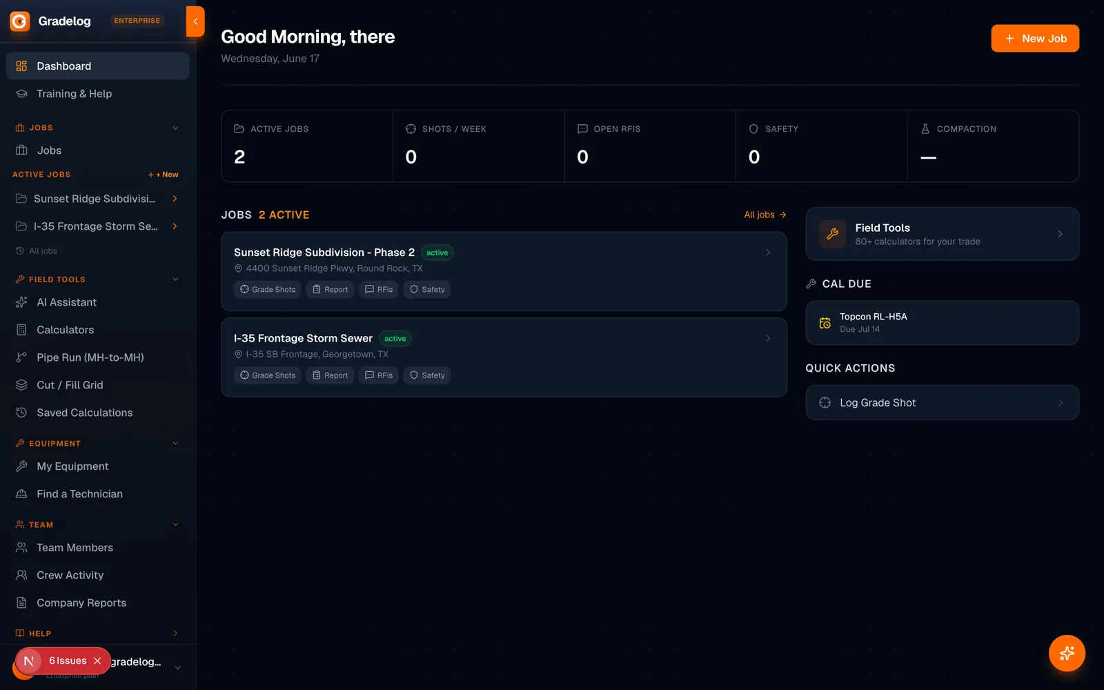
Gradelog is the field-execution platform built for grading and earthwork crews. Log grade shots, track cut/fill, document phases with photos, and generate as-built reports — from the cab to the office.
- Grade shots & cut/fill tracking per job
- Photo documentation by phase, task, and equipment
- As-built reports ready for inspector sign-off
- AI field assistant — troubleshoot on the jobsite
Built by the same team as Express Tools
Try Free →14 days
Free trial
8 languages
Supported
iPhone + Android
Works on